- Location
-
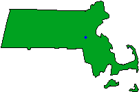
- Needham is located in eastern Massachusetts, just west of Boston in the "metro-west suburbs." It is bordered by Wellesley on
the west and northwest, Newton on the north and northeast, the West Roxbury section of Boston on the east, Dedham on the
southeast and south, and Westwood and Dover on the south. Needham is 10 miles southwest of Boston, 29 miles east of
Worcester, and just over 200 miles up the Atlantic coast from New York City.
-
-
- Check out this site for a map of Needham (and the rest of the world too). You can zoom in and out! Use the "back" key on
your browser to return to the Needham site after you've checked out the map!
-
-
- The picture below depicts a snowy afternoon in the Needham Town forest. While Needham is perhaps best known as a
bedroom community, it also has a variety of open and wooded spaces for walking, hiking, mountain biking, ball playing and
fishing.

Total Area:    12.70 sq. miles
Land Area:     12.61 sq. miles
Population:    27,557
Density:       2,185 per sq. mile
Climate (National Climatic Data Center)
(Blue Hill Station)
Average temperature in January.....25.3°F
Average temperature in July........71.2°F
Average annual precipitation.......49.0"
U.S.G.S. Topographical Plates - Newton, Natick
Regional Planning Agency - Metropolitan Area Planning Council
Metropolitan Statistical Area (1993 Definition) - Boston